Educator Onboarding
LEO Art Challenge Workshop
Satellite Tracking, Orbits, and Modeling
Workshop: Satellite Tracking, Orbits, and Modeling
Workshop: Trek-a-Sat
Workshop: Yerkes
Workshop: Electrostatics in Space - Carthage- Yerkes
Workshop: Life in Space! BTCI
Workshop: More Than a Rainbow - Yerkes
Workshop: Small Steps Teachimg Space Brings Giant Steps in Classrooms-SEEC
Workshop: 2017-01-28 Yerkes
Tools You Might Use
Educational Learning
Standards
Documentation
Google Spreadsheet for Data Analysis
完了要件
 First: Open and view the spreadsheet linked directly above.
Then: Find a school in your country are a country near you.
Next: Enter the following into your project journal.
- the latitude of that school.
- the longitude of that school.
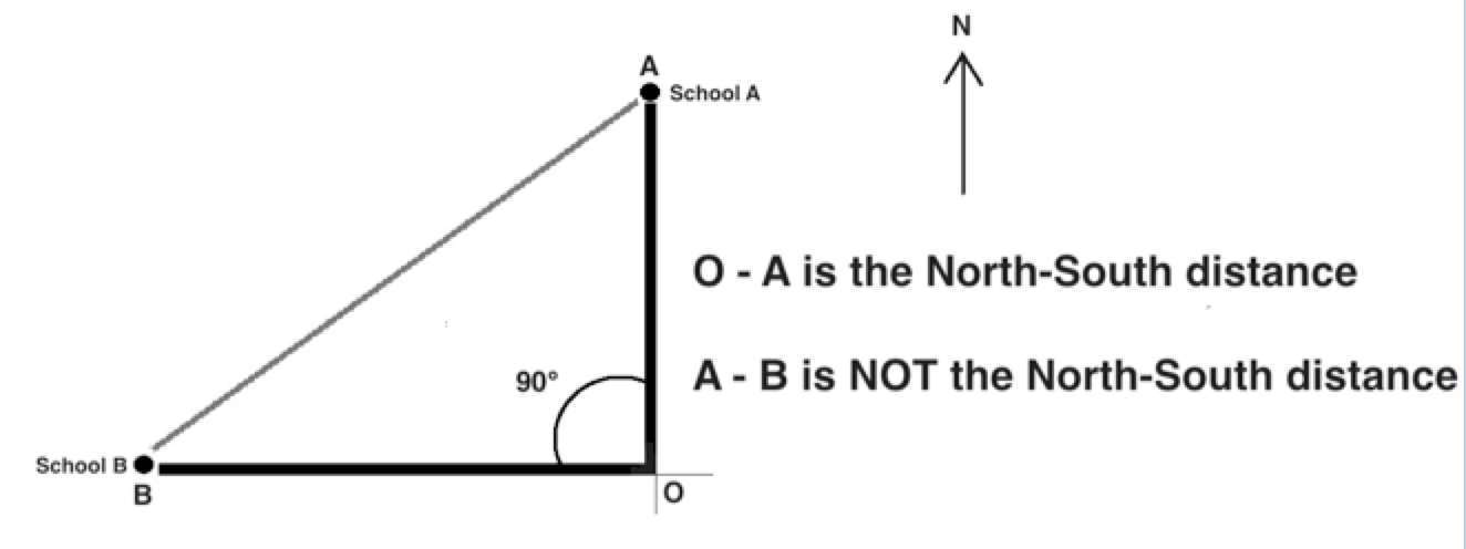
Last: Use a map to find the longitudinal distance (north-south distance) in kilometers between the two places and enter the distance into your project journal.
Now you are ready to complete the math:
1, Subtract the angle of inclination of the sun at solar noon at your location from the angle of inclination in your selected second school. This needs to be a positive number so take the absolute value of the remainder.
2. Divide this number into 360.3. Using a map, determine the distance in kilometers between you and the place you have chosen.
4. Multiply #2 x #3. The answer gives you the circumference of earth.
When you do the math, what is number of kilometers for the earth's circumference?
- Enter the answer into your project journal.
- Record your information and your answer into the survey at the bottom of this activity.
Next:
- Select four more cities either north and/or south of your location.
- Complete the calculation for the four other places.
- Record the information in your project journal.
- Take the average of these five circumferences.
- Record your information in the survey survey below!